36 Views of San Francisco Mountain
From 1830 - 1832 Japanese artist Katsushika Hokusai created a series of landscape prints titled: 36 views of Mt. Fuji. The most well-known image of the series, The Great Wave off Kanagawa, has been featured prominently in modern art and culture. The series of block prints was eventually followed up by another work, One Hundred Views of Mount Fuji. The pieces range from landscapes focused on the mountain to cultural scenes containing the mountain as a smaller background element. The works demonstrate the importance of the mountain to daily life in Japan. The French artist Henri Rivière, inspired by Hokusai created a set of color lithographs entitled Thirty-six views of Tour Eiffel.
When I arrived in Arizona in 2014, the first thing I noticed was the mountain. The San Francisco Peaks dominate the skyline of Flagstaff, Arizona. The San Francisco Peaks (Humphreys, Agassiz, Aubineau, Reese, and Doyle) are the highest peaks in Arizona, all with elevations over 11,400 feet, the highest, Humphreys reaches12,633 ft into the clouds. The Peaks are the remnants of a much larger stratovolcano known as San Francisco Mountain which collapsed sometime between 400,000 and 96,000 years ago.

San Francisco Mountain
Before the collapse the elevation of San Francisco Mountain is estimated to be somewhere between 14,000 and 16,000 ft. [image from https://www.snowbowl.ski/san-francisco-peaks-geology/]
The Peaks play a central role in daily life in Flagstaff, home to the Kachina Peaks Wilderness within the Coconino National Forest. Glades of aspen along the flanks and along the inner basin host hikers and mountain bikers. Arizona Snowbowl is located on the western side of the mountain below Agassiz peak, it has become a winter playground for many in the region. People come to the mountain for recreation and relaxation. However, these peaks have long been important to the indigenous peoples of the region. The San Francisco Peaks have considerable religious significance for at least 13 tribes in the area. They have come to be known by many names, here a just a few:
Dook'o'oosłííd - (Navajo) - “The summit which never melts”
Nuva'tukya'ovi - (Hopi) - “Place-of_snow-on-the-very-top”
Dził Tso- (Apache)
Tsii Bina- (Acoma)
Nuvaxatuh - (San Juan Southern Paiute)
Hvehasahpatch - (Havasupai)
Wik’hanbaja - (Hualapai)
Wimonogaw’a (Yavapai)
Sunha K’hybachu Yalanne - (Zuni)
‘Amat ‘likwe Nyava - (Mojave)
Sierra sin Agua - (Spanish) - “mountain range without water”
The Peaks (Anglo Arizonans)
In the summer clouds gather and grow from the summits of The Peaks, and thunderstorms follow. As such, the peaks are seen as the source of water in an otherwise parched landscape. For the Hopi, The Peaks are home to the Kachina Spirits, ancestors who have become clouds after their death. The mountains are considered a sacred space, and play a central role in many rituals. Recreation on The Peaks, and especially snow making using reclaimed water, has been a controversial issue, as many believe it disrespects the purity of this place.
In 2015, a friend suggested that I make a collection of the images I’ve taken of The Peaks in the four years that I have lived in their shadow. The Peaks have come to play a very central role in my own life, and I hope these images can show some of the moods the mountains take, and convey their significance to the people and culture of Northern Arizona. Below you will find some of my favorites. Eventually, I would like to collect these images, and storied about The Peaks into a book. If you have a story to share please email me rl587@nau.edu. If you want to share any images of The Peaks, please tag them with #36viewsofsanfranciscomountain.
The peaks were once called Sierra sin Agua, or the mountains without water by the Spanish, here they are seen from Anderson Mesa.

The Peaks from Walker Lake, a depressional wetland in the middle of a cinder cone just west of Hart Prarie.

An orange and purple sunrise from Cape Royal on the North Rim of the Grand Canyon. The peaks are over 56 miles away here.

Paragliders find favorable winds atop Merriam Crater. The snow covered peaks sit quietly to the south west.

SP Crater in the foreground is a cinder cone which erupted between 60k - 71k years ago, its name is an abbreviation for Shit Pot. In the 1880s Rancher C.J. Babbit described its appearance as that of a chamber pot which over-flowed, not pictured here is the 4-mile long lava extending out from its base toward the viewer. Colton Crater is in the middle ground, it was one of the sites used for vehicle testing in the Apollo missions. These cinder cones, and 600 other cones, lava domes, and lava flows make up the San Francisco Volcanic field, named after the peaks that dominate the background of this image.

Nuvatukya’ovi (Hopi for "place-of-snow-on-the-very-top") from Wupatki National Monument

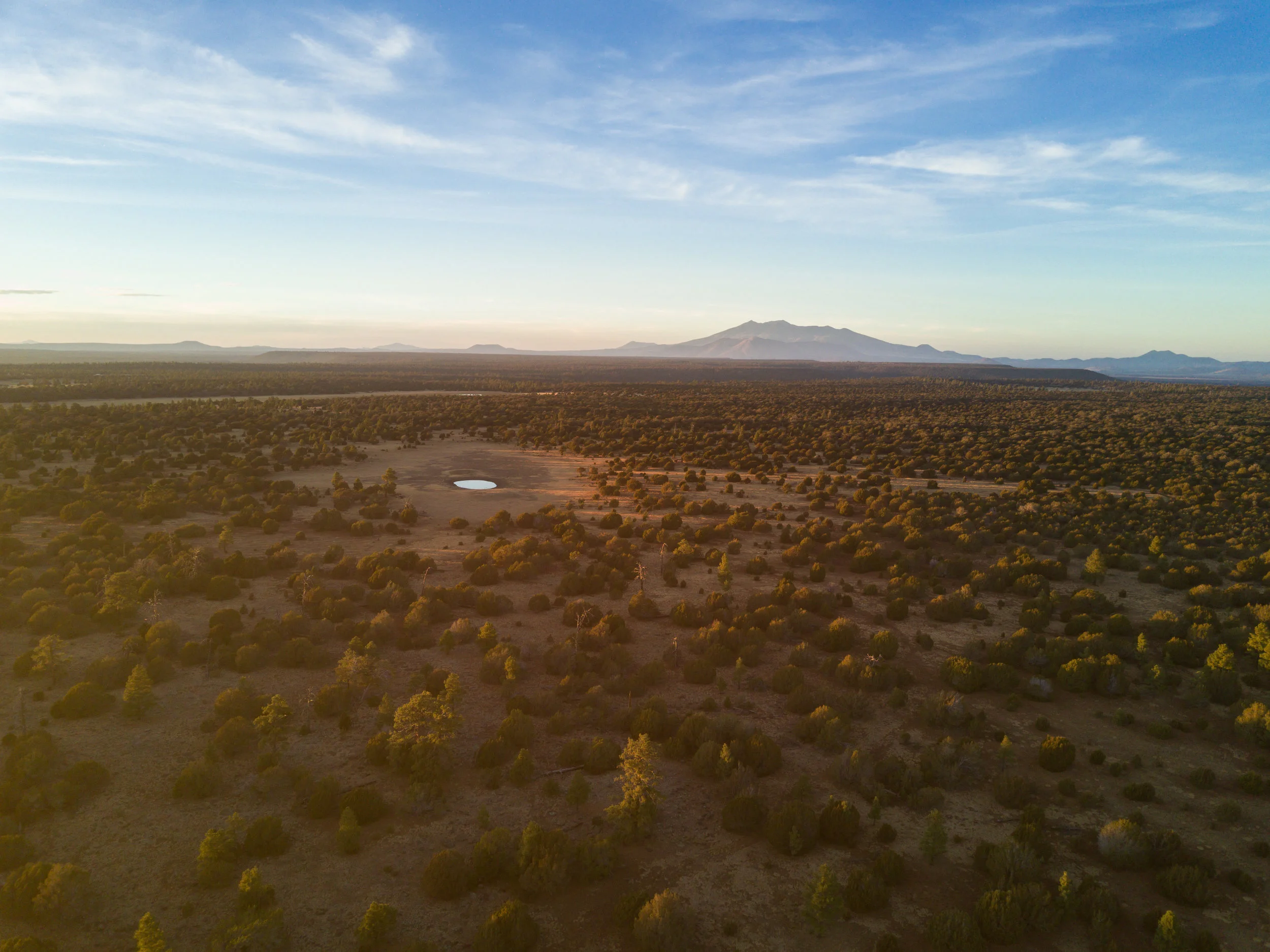
San Francisco Mountain from Government Prarie

The Peaks from Marshall Lake on Anderson Mesa, lakes like Marshall fill in the winters and provide essential habitat for waterfowl and amphibians.

Monsoon clouds gather over the peaks in early September as the prairies of Flagstaff fill with yellow flowers and undergraduate students trying to get that perfect instagram photo!

Mormon Lake after a wet spring with the peaks nearly 40 miles to the west.

The peaks are barely visible along the horizon behind a large cumulonimbus cloud dumping moisture on the parched earth near Joseph City, AZ

The 2019 Museum Fire burning in the Dry Lake hills, seen from McMillen Mesa.

Snowy San Francisco Mountain looms large from the Campus of Northern Arizona University

Dook'o'oosłííd (Navajo for “the summit which never melts”) glow pink in the background while sunset crater waits for first light.

The Peaks from the west side, near alfa fia tank.

San Francisco Mountain viewed from the south across Rogers lake, an ephemeral lake out on woody mountain road.

First Light hits Kendrick Peak above a layer of clouds. This picture was taken from Snowbowl. The presence of a ski resort on the mountain is controversial.
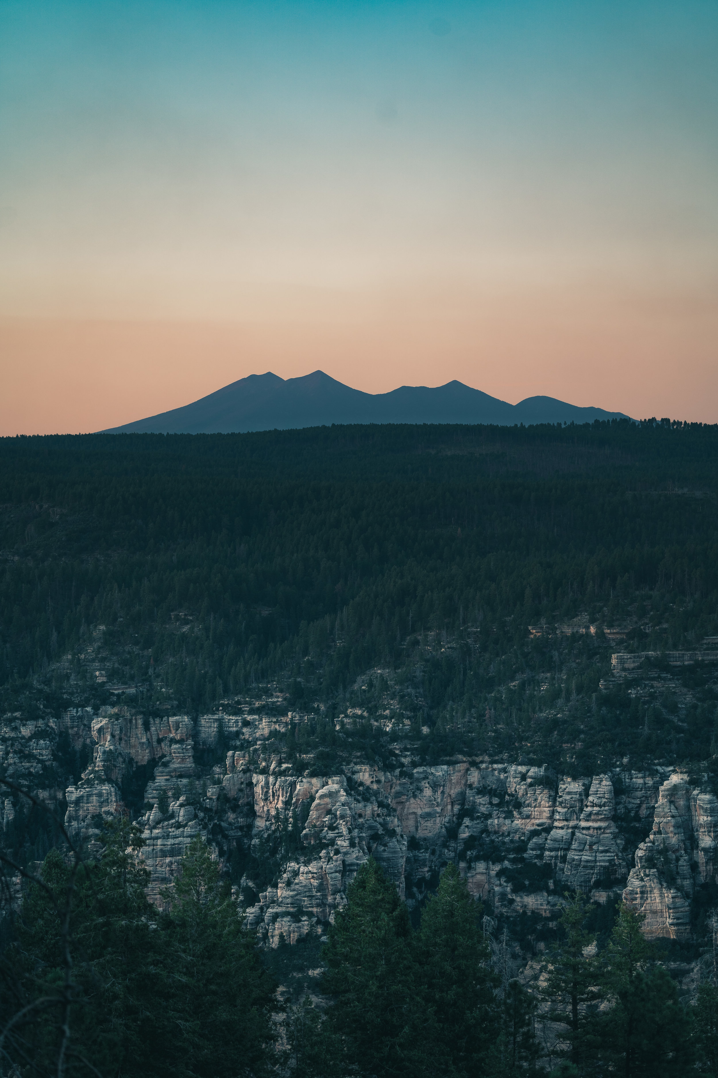
The West Fork of Oak Creek Canyon tears into the Colorado Plateau in the foreground, while San Francisco Mountain is silhouetted against the orange and teal twilight.

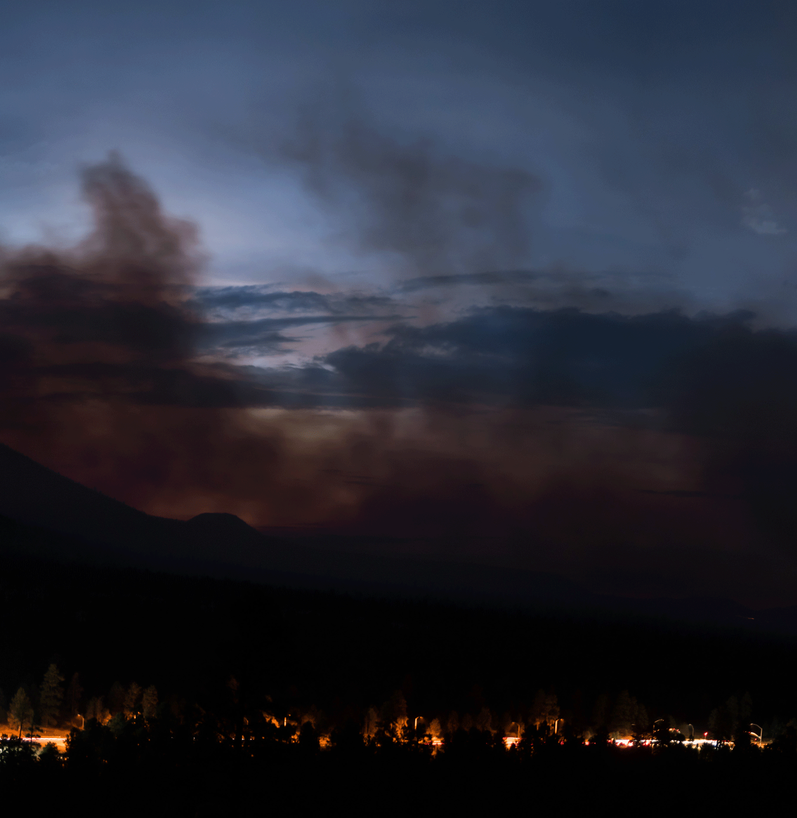
Smoke from wildfires brings a red-orange haze over the peaks, as viewed from atop Mount Elden


A five image panorama of the 2019 Museum Fire burning over Mt. Elden